customsteve01
-
Posts
1844 -
Joined
-
Last visited
Content Type
Forums
Events
Gallery
Everything posted by customsteve01
-
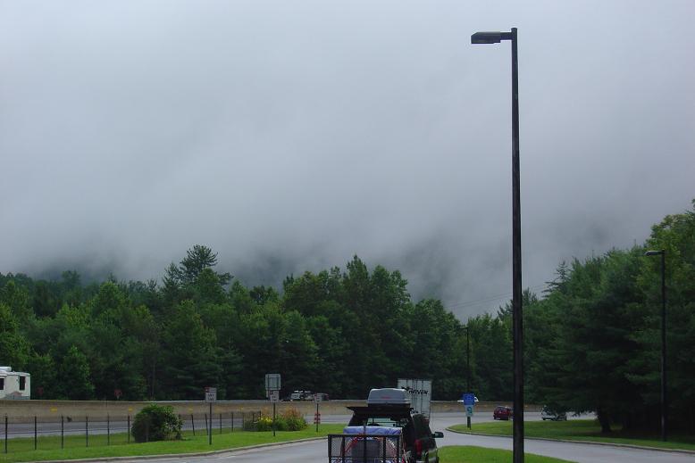
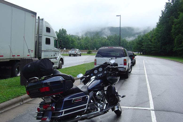
Day 16 07/20/09 Take a look at whare we camped last night. Yup, thats right on the coast. Stopped and had a big breakfast and spotted this cross section of a redwood. Its 13 feet from bottom to top. It turned out being really foggy most of the day. Made it to Oregon Coastline along 101. The Mary D Hume was in service for 97 years before being left to rot here. More coastline. http://i388.photobucket.com/albums/oo328/LoneStarAcres/DSC02802.jpg I dropped my camera yesterday and its been acting up all day today. well now it doesnt work at all. The following pictures I borrowed from Tom, the guy I met in Utah from West Virginia. I will stop into a Wally world tomorrow and pick up a new one. Caroline likes light houses and I saw the sign for the Cape Blanco Lighthouse. The fog was pretty much gone from the road we were on so we ventured down the 6 miles to the lighthouse. How the weather can change in 6 miles. http://i388.photobucket.com/albums/oo328/LoneStarAcres/S6003290.jpg http://i388.photobucket.com/albums/oo328/LoneStarAcres/S6003293.jpg Plus the light house was closed to tours on Mondays. http://i388.photobucket.com/albums/oo328/LoneStarAcres/S6003296.jpg http://i388.photobucket.com/albums/oo328/LoneStarAcres/S6003301.jpg Stopped for the night in Reedsport
-
Day 15 07/19/09 Left Yuba and stayed on Route 20 all the way to Route 1. Leaving Yuba its mostly farm land but you can see the hills off in the distance. Passed a few large grain elevators. More farm land and some tree farms Then up into the hills and past Clear Lake After Clear Lake it started getting greener and the trees started getting bigger. Some old logging equipment by the road. The end of 20 and the start of route 1 http://i388.photobucket.com/albums/oo328/LoneStarAcres/DSC02533.jpg Then it was just the "END" http://i388.photobucket.com/albums/oo328/LoneStarAcres/DSC02536.jpg OH MY, look what I have done. I made it to the west coast. http://i388.photobucket.com/albums/oo328/LoneStarAcres/DSC02546.jpg http://i388.photobucket.com/albums/oo328/LoneStarAcres/DSC02563.jpg Going north from Fort Bragg on Route 1 http://i388.photobucket.com/albums/oo328/LoneStarAcres/DSC02569.jpg It was lucky to have a nice weather day. http://i388.photobucket.com/albums/oo328/LoneStarAcres/DSC02573.jpg After a while route 1 joins up with 101 and you start moving away from the coast and into the redwood forest. http://i388.photobucket.com/albums/oo328/LoneStarAcres/DSC02584.jpg http://i388.photobucket.com/albums/oo328/LoneStarAcres/DSC02598.jpg http://i388.photobucket.com/albums/oo328/LoneStarAcres/DSC02631.jpg Its a really fun road too. http://i388.photobucket.com/albums/oo328/LoneStarAcres/DSC02597.jpg http://i388.photobucket.com/albums/oo328/LoneStarAcres/DSC02617.jpg After a while I decided to have fun and stop trying to take a picture of every big tree. My back is sore from throwing that big loaded down Ultra through the curves, but all I can say is it was a blast. Made it past Eureka and camped for the night.
-
Day 14 07/18/09 Left Fallon this morning and headed to Virginia City. It was more of the same along Route 50. Here is a couple of pictures to prove my point. Turned North on 341 and up into the town. There was a section that was tristy with a 14 deg. incline. Coming into town It still looks as it did many years ago. There were alot of bikes out today also. Inside one of the restaurants. and a bar. there are alot of people that dress up in period clothes and wander around. They also have gunfights. http://i388.photobucket.com/albums/oo328/LoneStarAcres/DSC02249.jpg http://i388.photobucket.com/albums/oo328/LoneStarAcres/DSC02251.jpg http://i388.photobucket.com/albums/oo328/LoneStarAcres/DSC02260.jpg http://i388.photobucket.com/albums/oo328/LoneStarAcres/DSC02262.jpg The old fire department was really cool. http://i388.photobucket.com/albums/oo328/LoneStarAcres/DSC02263.jpg http://i388.photobucket.com/albums/oo328/LoneStarAcres/DSC02268.jpg http://i388.photobucket.com/albums/oo328/LoneStarAcres/DSC02271.jpg Another old bar. http://i388.photobucket.com/albums/oo328/LoneStarAcres/DSC02292.jpg Even had horses. http://i388.photobucket.com/albums/oo328/LoneStarAcres/DSC02295.jpg I guess it can get pretty crazy at times in most of the bars. We were just there at the wrong time. http://i388.photobucket.com/albums/oo328/LoneStarAcres/DSC02302.jpg I had hooked up with another rider from West Virginia way back in Utah and he was doing just about the same thing I am. I have just been amazed at the other bikers out here that are doing long distance rides too. Well anyway we spent quite a while in Virginia City. We headed to Lake Tahoe around 1 or 2 pm. After ariving in Lake Tahoe we bidded farwell to Route 50. Last few pictures of Route 50. the ride up to the lake is really about the only part of this road that I have been on for 3 states that is pretty. http://i388.photobucket.com/albums/oo328/LoneStarAcres/DSC02314.jpg http://i388.photobucket.com/albums/oo328/LoneStarAcres/DSC02316.jpg http://i388.photobucket.com/albums/oo328/LoneStarAcres/DSC02318.jpg We turned north on Hwy 28 that goes around the lake. http://i388.photobucket.com/albums/oo328/LoneStarAcres/DSC02329.jpg http://i388.photobucket.com/albums/oo328/LoneStarAcres/DSC02338.jpg http://i388.photobucket.com/albums/oo328/LoneStarAcres/DSC02345.jpg http://i388.photobucket.com/albums/oo328/LoneStarAcres/DSC02354.jpg Tahoe is an amazing lake and I really wish my Sweetie Caroline could be with me on this part. http://i388.photobucket.com/albums/oo328/LoneStarAcres/DSC02351.jpg We stopped at the old set of Bonanza, its not open to the public anymore. the locals seem to think the new owners want to turn it into a B&B or some kind of time share place. http://i388.photobucket.com/albums/oo328/LoneStarAcres/DSC02359.jpg I have arrived in California. http://i388.photobucket.com/albums/oo328/LoneStarAcres/DSC02362.jpg Western side of the lake looking East. http://i388.photobucket.com/albums/oo328/LoneStarAcres/DSC02368.jpg After going arounfd the north side of the lake we headed up North on 89. It follows the Trukee River, the only river that flows out of the lake. http://i388.photobucket.com/albums/oo328/LoneStarAcres/DSC02386.jpg http://i388.photobucket.com/albums/oo328/LoneStarAcres/DSC02388.jpg Then west on I-80 for a short while to 20 West. We stopped in Yuba for the night and will head to HWY 1 and on up to Eureka in the morning.
-
Day 13 07/17/09 Campsite at Great Basin. Rode up to the end of the road in the Great Basin, up to 10,000 feet. I really wanted to camp up here last night but was not going to ride all the way up here in the dark. Where the road ended there was a trail up to Wheeler Peak. the hiking trail only went up another 3000 feet and took 8 to 10 hours. I will save that hike for another day... Wheeler Peak A creek at the upper campground The view from the top. The ride down. See why you wouldn't want to do this in the dark. Stopped for some coffee at this little store in Baker. The store was a multi purpose shop. It was also the movie theatre on Friday nights. Here is route 50 again. Its called the lonliest road in Nevada. Finally got cell service back in Ely. And was able to check in with my sweetie and let her know everything was ok. Ok I am not really sure how to log the rest of today. "The Lonliest Road" is really an understatment. You basicly go over a mountain range into a valley then over another mountain range then repeat, all day long. http://i388.photobucket.com/albums/oo328/LoneStarAcres/DSC02124.jpg http://i388.photobucket.com/albums/oo328/LoneStarAcres/DSC02136.jpg http://i388.photobucket.com/albums/oo328/LoneStarAcres/DSC02139.jpg http://i388.photobucket.com/albums/oo328/LoneStarAcres/DSC02146.jpg The town of Austin, NV http://i388.photobucket.com/albums/oo328/LoneStarAcres/DSC02150.jpg http://i388.photobucket.com/albums/oo328/LoneStarAcres/DSC02155.jpg Between Austin and Fallon http://i388.photobucket.com/albums/oo328/LoneStarAcres/DSC02156.jpg http://i388.photobucket.com/albums/oo328/LoneStarAcres/DSC02159.jpg http://i388.photobucket.com/albums/oo328/LoneStarAcres/DSC02167.jpg http://i388.photobucket.com/albums/oo328/LoneStarAcres/DSC02171.jpg http://i388.photobucket.com/albums/oo328/LoneStarAcres/DSC02188.jpg http://i388.photobucket.com/albums/oo328/LoneStarAcres/DSC02201.jpg Does it ever end??????? http://i388.photobucket.com/albums/oo328/LoneStarAcres/DSC02207.jpg Stopped in Fallon for the night. Tomorrow off to go around Lake Tahoe and on into California, will I make Eureka?
-
Day 12 07/16/09 Had a good nights sleep and got up with the sun. Packed the bike up and headed out. Saw some wild life on the way out. A couple of pictures of Soap Creek Canyon I took 92 west which runs the north side of Black Rock Canyon. This was an awsome ride with lost and lots of twisties. Most of the road is right on the edge of the canyon and no gaurd rails. There are parts that are 800 feet to the bottom. Can you say pay attention to the road? Yes thats about 800 feet to the water. The sign said this rock formation was 700 feet out of the water and look how much higher I am. Still on 92 following the canyon Some white birches I believe. Ok made it off 92 and back on 50. I made it to Utah. It only took 3 hours to do 118 miles this morning. The Twisties on 92 took up some time and ate alot of miles. http://i388.photobucket.com/albums/oo328/LoneStarAcres/DSC01979.jpg These next pictures are fron the Utah boarder to Salina. Pay very close attention to the last picture and do not try this, it makes you sweat more than the heat does. http://i388.photobucket.com/albums/oo328/LoneStarAcres/DSC01985.jpg http://i388.photobucket.com/albums/oo328/LoneStarAcres/DSC01996.jpg http://i388.photobucket.com/albums/oo328/LoneStarAcres/DSC01998.jpg http://i388.photobucket.com/albums/oo328/LoneStarAcres/DSC01999.jpg http://i388.photobucket.com/albums/oo328/LoneStarAcres/DSC02017.jpg http://i388.photobucket.com/albums/oo328/LoneStarAcres/DSC02019.jpg http://i388.photobucket.com/albums/oo328/LoneStarAcres/DSC02027.jpg Ok I put 5.5 gallons in a 6 gallon tank. The lesson here is pay attention to the signs for gas stations. They are far and few. What happened is I missed the sign that said no gas for 100 miles. These pictures are from Salina to the Nevada boarder, still on 50. Signs said this was a controlled burn and do not report it. http://i388.photobucket.com/albums/oo328/LoneStarAcres/DSC02032.jpg 50 is long and straight and the scenery looks the same. Can you say "The Road Goes on Forever"? http://i388.photobucket.com/albums/oo328/LoneStarAcres/DSC02037.jpg http://i388.photobucket.com/albums/oo328/LoneStarAcres/DSC02044.jpg http://i388.photobucket.com/albums/oo328/LoneStarAcres/DSC02047.jpg http://i388.photobucket.com/albums/oo328/LoneStarAcres/DSC02066.jpg Made it to Nevada. http://i388.photobucket.com/albums/oo328/LoneStarAcres/DSC02073.jpgStopped in Baker to get a quick dinner before going into the Great Basin to camp for the night. Well it didn't turn out quick and it was dark riding to the camp site. Have been without cell service since Salina and not sure when I would get it back. The waitress said they didn't get power out here till 1976....
-
Day 11 07/15/09 Part 2 Boy, not getting cell or internet service for 2 days put me really far behind on this thread. I hope you guys can bear with me doing multiple days at once. I left Gunnison and headed out to the Blue Mesa Resivoir. What a beautiful lake, it is some 400 feet deep at the dam. I rode out 50 and it crosses over the lake several times, at the junction of 92, 50 stays on the south of Black Rock Canyon while 92 takes the north route. I took 50 all the way to Cimarron where it heads to Montrose instead of following the canyon. I turned around and headed for my camp site. This is the back side of the dam and the start of Black Rock Canyon I talked to a ranger and he told me that one of the best campsites on the lake was up at the end of Soap Creek. Which was about 7 miles up a hard pack gravel road. Made it to the camp gound and set up the tent. Sun set from the campsite, pretty nice huh?
-
Sorryy guys let me catch you up. I am still on the coast of Oregon. Will turn East today. Steve
-
Day 11 07/15/09 part 1 Like I said spent the night in a motel least night instead of camping. Here is the view from the parking lot. Bike packed up again ready to roll. Town sign I headed west on Hwy 50 to go over Monarch pass and on the Gunnison and beyond but how things change. I saw this really detailed horse sculpture The ride up to the pass was really nice and twisty. Made it to the pass safe and sound, it was a little chilly and had to put on a light jacket. Some riders were in full leathers. I decided on taking the gondola ride to the top of the mountain up another 1000 feet. The mountain top is at 12,000 feet and the view was breath taking. Going up??? http://i388.photobucket.com/albums/oo328/LoneStarAcres/DSC01835.jpg http://i388.photobucket.com/albums/oo328/LoneStarAcres/DSC01837.jpg http://i388.photobucket.com/albums/oo328/LoneStarAcres/DSC01838.jpg Still snow on the ground http://i388.photobucket.com/albums/oo328/LoneStarAcres/DSC01844.jpg Not a bad picture for a point and shoot. http://i388.photobucket.com/albums/oo328/LoneStarAcres/DSC01857.jpg The ride down was a blast. It was a 6 deg. decent for 9 miles of twist and turns. I had both the gondola operators warn me that its a dangerous ride down the west side and that they loose about 1 biker a week. I found that if you do the posted speedlimit and pay attention to what your doing it was a thrill. http://i388.photobucket.com/albums/oo328/LoneStarAcres/DSC01860.jpg At the bottom shiney side up. http://i388.photobucket.com/albums/oo328/LoneStarAcres/DSC01861.jpg A few pictures of the ride into Gunnison. http://i388.photobucket.com/albums/oo328/LoneStarAcres/DSC01856.jpg http://i388.photobucket.com/albums/oo328/LoneStarAcres/DSC01868.jpg http://i388.photobucket.com/albums/oo328/LoneStarAcres/DSC01875.jpg I decided to go ahead and camp where I planed to last night. I also am going to change my route a little in the morning. Instead of taking hwy 50 all the way I am going too turn North on 92 which will meet up with 50 in Delta. This will add some time but I have been told it is a really neat road. So far this trip has been so great and I still have so many places to see. I also think I will go all the way to Hwy 1 in Califoria instead on 101. Hope I am not putting too many pictures in this thread. its just a drop in the bucket of what I have taken. Steve
-
Day 10 70/14/09 Updated on 07/15/09 The day started off really good. The weather was great for riding and not a cloud in sight. I got started alittle later than I had wanted but I needed a few things at Walgreens and I stopped for breakfast. Once on the road and headed north on 87/287 I was putting miles behind me. Amarillo is in my rearview mirror Some of the mostly flat lands between Amarillo and Dumas There is a long bridge for the train in this pic. At Dumas, TX 87 splits off of 287 so I made the left turn to continue on 87 North. I met two retired Oklahoma State Troopers that were also headed into Colorodo so we decided to ride together for a while. They were on GoldWings..... It was kinda cool John was on a red bike Don was on a white and me on a blue This is the way to grow corn, but it does take alot of water. Before getting into Dalhart I stopped and watched this crop duster for a bit. Dalhart has 3 of these big grain elevators Mew Mexico state line First sign of some hills Passed this group of bikers http://i388.photobucket.com/albums/oo328/LoneStarAcres/DSC01731.jpg Hills getting closer and closer http://i388.photobucket.com/albums/oo328/LoneStarAcres/DSC01733.jpg http://i388.photobucket.com/albums/oo328/LoneStarAcres/DSC01735.jpg These clouds in the distance do not look very good. http://i388.photobucket.com/albums/oo328/LoneStarAcres/DSC01741.jpg Here are the red, white and me on the blue http://i388.photobucket.com/albums/oo328/LoneStarAcres/DSC01746.jpg In Raton, NM it did try and rain a little but not enough to get out the rain suit, it was nice to be cool tho. Actually when I passed the welcome to Colorado sign it was raining so I waited till the welcome center to stop for some pictures http://i388.photobucket.com/albums/oo328/LoneStarAcres/DSC01748.jpg Some from the rest stop. You can see the storm I rode thruogh http://i388.photobucket.com/albums/oo328/LoneStarAcres/DSC01749.jpg http://i388.photobucket.com/albums/oo328/LoneStarAcres/DSC01751.jpg First sight of the mountains on I-25 North headed to Pueblo http://i388.photobucket.com/albums/oo328/LoneStarAcres/DSC01754.jpg Just North of Colorado City I crested a hill and pulled over for some pictures http://i388.photobucket.com/albums/oo328/LoneStarAcres/DSC01757.jpg When I stopped I smelled oil burning. Looked around on the bike and noticed oil on the timing cover. It was coming from where the oil filter adapter goes when you install an oil cooler. http://i388.photobucket.com/albums/oo328/LoneStarAcres/DSC01760.jpg I located Outpost Harley that was not too far off my route. they were able to get me right on in and replace the gasket. They did a great job but I still lost 3 hours, so my plan to make it past Gunnison was not going to happen. I decided to go as far as Salida and stay the night there. I was really wanting cooler weather, it was 100 in Pueblo. I stopped as the Royal Gourge and walked across the bridge, if I had known you could drive across it I would have done that. http://i388.photobucket.com/albums/oo328/LoneStarAcres/DSC01771.jpg Long way down http://i388.photobucket.com/albums/oo328/LoneStarAcres/DSC01769.jpg http://i388.photobucket.com/albums/oo328/LoneStarAcres/DSC01779.jpg http://i388.photobucket.com/albums/oo328/LoneStarAcres/DSC01787.jpg Hwy 50 follows the Arkansas River and is a really fun ride. You forget you are going up all the time. http://i388.photobucket.com/albums/oo328/LoneStarAcres/DSC01790.jpg http://i388.photobucket.com/albums/oo328/LoneStarAcres/DSC01791.jpg http://i388.photobucket.com/albums/oo328/LoneStarAcres/DSC01794.jpg I was getting dark as I rode into Salida so I decided to get a motel room for the night.
-
Ok Time for another installment of "Devil Duck goes Cross Country"..... lol Day 9 07/13/09 It's hard for me to believe that I have been away from home for 9 days already. I really feel this is the first day of the trip. For the last few years I lived in VA but worked in Houston, TX and comutted back and forth all the time, and I lived in Houston for 11 years prior to moving to VA. Plus today is the first day of the trip that I have really been solo also. Enough of all that lets get on with what Happend today, Thats what you guys want to know, right.... Well I was up around 7:30 and got ready but still had to load up the bike. Left my friends house around 8:30 or 9:00 I think, didn't really pay attention to the clock I was hot and sweaty already and knew it was only going to get worse. Ready to leave. Headed up to Tomball to say "see ya later" to my Dad and grabbed a quick bite foor breakfast. Headed up 249 at 10:30 then turned left on 105 to HWY 6 North Alittle shot of 105 HWY 6 takes you thru College Station home to Texas A&M then thru Hearn and Calvert. Calvert has a bunch of old shops and the Yellow Rider as I call him. He has been there for a long time and never gotten anywhere. Actually he did move across the street a few years ago. If you want some Texas stuff go in this store Yellow Rider Shot of main street Calvert When coming down from Dallas the other day I told you about the corn dead in the fields well here it is. This is on I-35 south of Fort Worth It looks like they are just plowing it into the ground. Oh did I mention that is has been increadably hot today... I can't wait to get into some cooler weather. After getting thru Fort Worth I headed North on 287 and stayed on this all the way into Amarillo. I saw a sign at a truck stop near Wichita Falls that said it was 112 degrees. I thought about turning around to get a picture of it but I did need gas and I really didn't want to prolong todays ride by even 15 min. yes it was that hot. here are some shots along 287. Just Northwest of Fort Worth coming up on Wichita Falls I saw two trucks hauling tires, yes those are tires. Each truck had 3 big and 3 little tires. http://i388.photobucket.com/albums/oo328/LoneStarAcres/DSC01688.jpg It started getting alittle greener as I past Wichita Falls, but it didn't get any cooler. http://i388.photobucket.com/albums/oo328/LoneStarAcres/DSC01690.jpg http://i388.photobucket.com/albums/oo328/LoneStarAcres/DSC01691.jpg Not too bad of a self picture going 75 down the highway. http://i388.photobucket.com/albums/oo328/LoneStarAcres/DSC01693.jpg I stopped to get a this picture and noticed the train coming so I waited and got some of the train too. Most of the trains I saw today were really long and they had 2 engines in the front and two more in the back. http://i388.photobucket.com/albums/oo328/LoneStarAcres/DSC01697.jpg http://i388.photobucket.com/albums/oo328/LoneStarAcres/DSC01698.jpg http://i388.photobucket.com/albums/oo328/LoneStarAcres/DSC01699.jpg This is the direction I was riding with the sun right in my face. http://i388.photobucket.com/albums/oo328/LoneStarAcres/DSC01700.jpg And the end of the train. http://i388.photobucket.com/albums/oo328/LoneStarAcres/DSC01701.jpg The sun set about 30 min. before I got into Amarillo and it was a really comfortable riding tempature. http://i388.photobucket.com/albums/oo328/LoneStarAcres/DSC01702.jpg I rode 577 miles in right at 11 hours and I think I mentioned it was really HOT didn't I. I told the clerk when I checked into the motel that I just needed a room with a good airconditioner. Well thats it for today kids.
-
Looks like I got alittle behind, let me chatch you up. Day 7 07/11/09 Made it to Tomball, staying with friends not much else to say and no pictures. I did go get a oil cooler and put it on. Day 8 07/12/09 Left for the Gulf Coast around 11 am. We went west to Dayton on FM 1960 then over to 90 and then down 365 at Nome through Winnie to 124 South down to High Island, then down the coast on 87 to Bolivar to catch the ferry over to Galviston. Was a nice ride to the ferry. We had to wait an hour to get on the ferry then over to Galviston. We ate at Tortuga Coastal Cantina on 61rst street. Then headed up I-45 to Richard and Carols house. It was a really hot ride home. Here we are waiting on the ferry and the line looking both directions I am going to head out in the morning and try to make Amarillo, Talk to yall soon.
-
Oh, Devil Duck did get to go for a swim in the Lambs Rest Inn pool. I didn't get him out at Carolines Daughters house because my grandson would have wanted to keep him. lol
-
Day 5 07/09/09 and start of Day 6 07/10/09 Didn't get to post these yesterday, we were visiting with Carolines daughter, husband and our grandson. It was really noce that they have a pool. It was so refreshing to get in the water. It was in the triple digits yesterday. I will say the cool vest helps alot in this heat. Before we left I took a few pictures of the outside of the Bed and Breakfast we stayed at. Its the Lambs Rest Inn. Its in New Braunsfels but really closer to Greune. It is the only B&B that is on the water. They have some really nice landscaping and decks out back. The Inn from the front. Looking from the upper porch down to the river. Down this path leads to the decks by the river. The upper deck The lower deck Devil Duck wanting to get in the river. They had a really cool gazebo made from old doors. It had a two person swing and ceiling fan. You could sit here with a drink, book and your wife and just relax and watch the river. Stopped for gas aways outside San Antonio and met Val from Michigan, she was on a VRod and had rode out to the Grand Canyon and was on her way to Katy. We were passing right by there so we rode together for about 100 miles. It was 103 today. Today We are going to head North to around Tomball, its only about 45 miles or so. Staying with more friends up there.
-
Larry, Thanks for the ideas. I have tweeked the route. Take a look at the new link. http://maps.google.com/maps?f=d&source=s_d&saddr=3571+Pineview+Dr.+Powhatan,+VA+23139&daddr=I-40+W+to:I-30+W+to:I-35+S+to:US-59+S+to:TX-249+N+to:I-40+W+to:W+Tomichi+Ave%2FUS-50+to:US-50%2FUS-6+to:US-50+E+to:CA-89%2FW+Lake+Blvd+to:CA-267%2FNorth+Shore+Rd+to:CA-49+to:E+Hwy-20%2FCA-20+to:US-101+N+to:CA-299+to:US-97+N+to:E+Hwy-26%2FOchoco+Hwy%2FUS-26+to:44.88312,-117.020874+to:US-12+to:I-90+E+to:I-90+E+to:I-680+E+to:I-465+S+to:3571+Pineview+Dr,+Powhatan,+Virginia+23139&geocode=%3BFaQJKAIdWJ_g-g%3BFQ5UBQIddGdw-g%3BFbwOxQEd1PEm-g%3BFdINxAEdSFJN-g%3BFdmyyQEd6JdN-g%3BFX4AGQIdzBju-Q%3BFQYkTAIdhlOg-Q%3BFRyXVAIdSM8w-Q%3BFf5OVgIdgNbd-A%3BFVYXVAIdwgTX-A%3BFfIJVwIdPPjX-A%3BFZrGWwId-pjO-A%3BFRKDVAId_jyu-A%3BFQrybQIdgQSZ-A%3BFQIVbgIdOiSp-A%3BFe4joAId4ALF-A%3BFYxMpwIdhFTZ-A%3B%3BFQxAwAIdWFEc-Q%3BFS4fugId9POH-Q%3BFdgGoQIdqGfY-Q%3BFZQneQIdLEVJ-g%3BFZKSYAIdhgTf-g%3BFWz7OwId53pb-w&hl=en&mra=dme&mrcr=11&mrsp=18&sz=8&via=10,11,12,13,15,17,18&sll=44.960911,-117.685547&sspn=1.978366,7.009277&ie=UTF8&ll=39.402244,-112.807617&spn=34.351096,112.148437&z=4 Steve
-
Larry, Thanks for the suggestions I will look at them tomorrow. I really like the idea of not borring. Mike I will keep you guys posted on where I think I will be, but let me see how traveling goes when I actually leave Houston. Steve
-
Day 4 07/08/09 Today is my sweeties birthday so I let her sleep in and went for a ride around the area and took a few pictures. Stopped at Gruene Harley. Bought a hydro vest that I will try out tomorrow on the ride to Houston. The Famous Gruene Hall is one of the original buildings in the town and has hosted many named musicians. The likes of Goerge Strait, Pat Green, David Allen Cole to name a few. Its really a pretty cool family bar. I parked my bike here and started to walk across the street to take this picture and a guy comes running out saying sir, sir you can't park here. I said I know I just want to take a picture. he goes oh ok and walks back inside. It is also a dance hall. One of the antique malls and restuants in town. The Gruene River Grill has great food too. The Gruene Water Tower. Sort of a neat shot i think. Bubba's Big Deck is a Biker Bar right on the river One of the many tude rental places on the river. You get in the river here and they come pick you up in a bus down river and put the tubes in the big trailer. This is a really small bridge under the railroad. It's only one car wide and 7 foot 10 inches high. http://i388.photobucket.com/albums/oo328/LoneStarAcres/DSC01622.jpg FM 1863 between state road 46 and 281 in Bulverde. notice how dead the grass is here. http://i388.photobucket.com/albums/oo328/LoneStarAcres/DSC01623.jpg Some houses built on the cliffs out by Caroline's sister's house http://i388.photobucket.com/albums/oo328/LoneStarAcres/DSC01625.jpg We will be headed to Sugarland TX some time tomorrow I will post more from there. Tonight we are staying in a Bed and Breakfast Just on the outskirts of Gruene. Its actually right down the street from that railroad bridge.
-
Well we made it to Bulverde, TX. Man did it get hot today in Texas. I didn't realize that I had gotten so UNaclimated to the heat. Did 650 miles again today but did I say the heat killed me. Didn't take tons of pictures cause we used to live here and have alot from around here. I do wish I would have taken some of the corn fields we passed. They are having a really bad drought and the fields are just dead. Left Little Rock at 8:00 am and didn't stop till the Texas border about 140 miles. the texas welcome sign was missing due to all the road construction at the border. these were from the welcome center. Who is this bad looking guy with a rubber duck on his shoulder? Carooline pulled up beside me and took this one. I thought this was pretty cool, how many of us have a picture of ourselves rolling down the road? I did stop before getting into Dallas. This is Lake Ray Hubbard, the Dallas skyline is in the distance you just can't see it in the little version. I also stopped to pay my respects to my mother. This is at the entrance of the DFW National Cemetery. At her grave. She passed Thanksgiving day of 2008, man do I miss her. I Love You Mom. The view. This is the Dallas Baptist University That is right next to the cemetery. No pictures from Dallas to Bulverde but I will ride thru this area again Sunday or Monday. Not riding anywhere tomorrow, we have some business to attend to. But I might ride out to Gruene Harley and I will try and take some pics of the area. I understand the river is almost dry. Its really sad cause there are alot of toobing companies that depend on the river to make money. I would really like ideas from you guys. My route is just a guide and I want ideas on how to make it better. We stopped for a couple of hours tonight just south of Austin to have some dinner and I needed to cool off. We got back on 35 just to get stuck in construction for about 45 min. The bike and I got hot all over again. Did I say it was hot today? I believe it was 98 or so. More to follow..............................
-
Oh, I forgot to mention that Custom 3's are in use while on the bike so I am getting good tunes the whole time. Steve
-
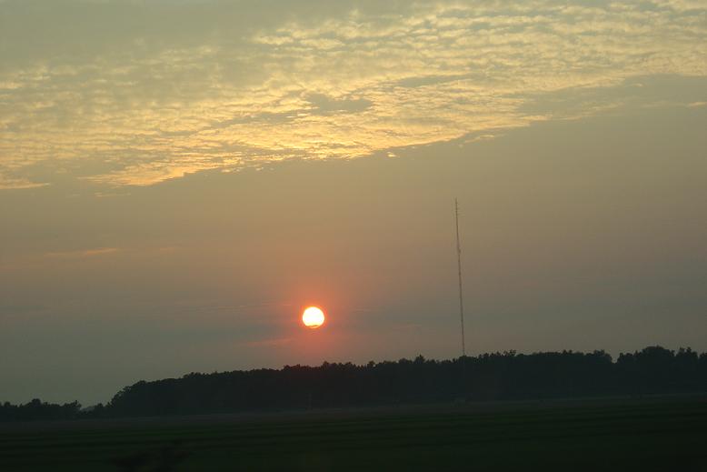
We made it just south of Little Rock. Around 650 miles for the day. Not to shabby. Here is one last picture of the sun setting over some rice fields. Only 500 miles for tomorrow. We are headed to Bulverde, TX to Carolines sisters house.

-
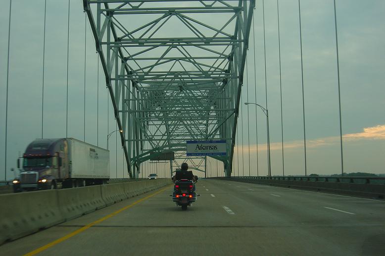
Arkansas, going over the mighty Mississippi River.
-
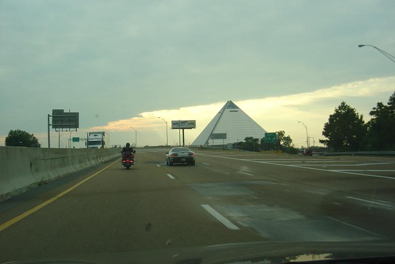
Leaving Tennessee we pasted this building. Not sure what it is.
-
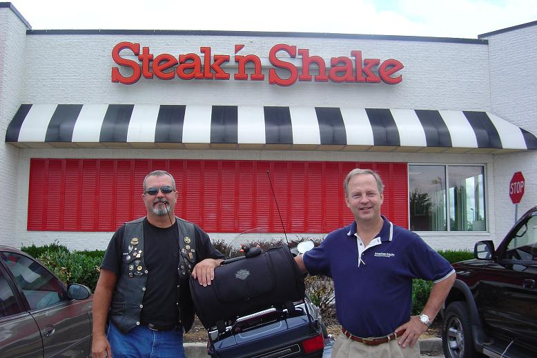
We got into Knoxville and called Richard (Coytee) and he had us meet him at his office and then took us to lunch. We went to Steak n Shake, it was very good. I ate too much but I was hungry. DD came out from his hiding place for a picture.
-
And getting thicker. These pics were only taken about 10 min apart.
-
On I-40 just before getting into Tennessee the clouds were getting thicker and I thought it might rain at anytime, it never did but it looked cool riding all thru the mountains with the clouds this thick.
-
Day 2 07/06/09 We rode 330 miles yesterday and was up and ready to roll at 8:00 am. As you can see DD was ready also.